
There we were, with a bigger chunk of solid ground under our feet than we’d seen since leaving Baja. That chunk of ground is the southern end of the Ryukyu island chain, which extends from mainland Japan almost to Taiwan, separating the South China Sea from the Philippine Sea. For the map inclined, we made landfall on the SE side of Okinawa (web image credit: Wikipedia).

So, with the solid ground of Yonabaru, Okinawa under our feet, what did we do? We started walking and quickly realized that our leg muscles had in fact atrophied. Here I am puzzling at how muscle disappears when you sit on your bum for 9 months.

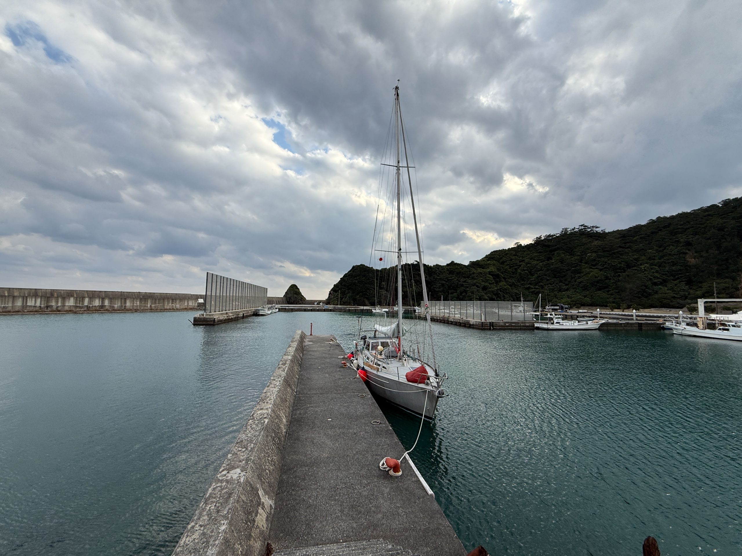
We also puzzled at the enormous amount of concrete used along the Japanese coastline. There is scarcely an unreinforced stretch of coastline, including many where you say to yourself- “why the heck would they have built that.” It benefits us though, with many small, secure, and almost entirely free fishing ports to stay in.

But before I get carried away with the boating, as I am want to do, I must allocate some time to the food! Fresh veggies, fruit, cooked food…what a relief! So many delicious and nutritious options to fuel the hopeful re-growth of our leg muscles!

In that vein, more than veggies are necessary to fuel us, so we made our way the whopping .5 km from the marina to the local brewery (our legs can handle that) and got a tour from the wonderful owner / brewers. The next day they came over to the boat and we all went out to a beer tasting in Naha, across the island. We didn’t let the lack of a shared language get in the way, and they liked that we were from the same place as their hops.

And, in case beer and veggies weren’t enough, we of course found soft serve ice cream – made from purple potatoes.

And just like that, after 5 days, we were once again itchy to get moving and had good weather for a jump to the north. By arriving in mid-winter, we anticipated strong N winds. Our approach has been generally to move north when the wind dies, in the hopes of minimizing the bashing upwind. This approach worked as we made it to the north end of Okinawa. As we left Yonabaru, US patrol boats greeted a huge submarine that surfaced just behind us.

The nice weather held, and we spent the night in the small Ada fishing port on the north end of Okinawa with a wonderful local coop store and a hike to a lighthouse.

These ports have taken some getting used to. You drive in, watching the depth closely, and try to find an open and unused looking wall to tie to.

These are massively fortified ports with typhoon fencing, usually some haul out ramp, and significant amounts of rope in the water, often connected to concrete mooring blocks (which we have yet to hit).

The weather again held and we motored and sailed further north the following day to Yoron – the mediterranean of Japan! They even have Greek names for streets, a Greece-themed hotel, and beautiful crystal-clear water.

After soaking up Yoron’s good vibes (by which we mean discovering and devouring local treats from the sugar cane factory), we set our sights on a favorable window for an overnight passage. We knew that the next few stretches north would be difficult to accomplish in daylight hours, and, given the uncertainties of shallow port entrances, we did not want to arrive at night.

Furthermore, there is fishing gear everywhere (every beach seems to be covered in it), and boats without AIS or lights. Many of the small fishing boats out at night barely show up on radar. From Yoron we decided to wait for a strong southerly and sail overnight to Amami, a large island with secure harbors. We got the wind we were waiting for and a bit more. The sail took just over 12 hours with a top boat speed around 14 knots (too fast) after leaving at last light from Yoron. Before we left, we were treated with a beautiful sunset!

The entrance between Amami and Kakeroma to the south feels like a narrow fjord in British Columbia or Southeast Alaska. Steep forested slopes rise out of a winding channel, although the water here is crystal clear and still in the high 60s. It was raining and gusting into the mid 30s, so we found a hidy hole with a secure mooring ball to sleep away the day on.

The following day, before a forecast north wind, we decided to try Seso Port on Kakeromajima. We tied up and took off for what ended up being the first of many wonderful walks.

This walk took us across to the south side of the island and through three small towns. These towns all have a feeling of partial abandonment, with a significant proportion of the houses empty.

The tiny roads (sized for tiny Japanese vehicles) wind through lush and strange forests and itty-bitty alleys. We returned to the boat and found that the small coop store happened to have (once again) wonderful passionfruit soft serve.

The next day we moved across to the main port at Koniya, as we knew strong north winds were forecast and we wouldn’t be going anywhere for a while. Time for more walking!

While we were already blown away by the coastal concrete infrastructure, we weren’t ready for the level of love that the Japanese seem to hold for concrete everywhere. Tiny mountain roads would have huge grates of concrete for slope stabilization, and a walk up any mountain stream ends in enormous check dams. We regularly came across kilometer plus long tunnels on tiny roads, fully passable and often lit with large sidewalks!

After a spell of nice weather, wind and rain showed up. As northwesterners, we were raised to wear rain gear and shun umbrellas. That lasted for about one day on Amami. On that first day we walked up the main road out of town in a light downpour. A small pink van made a U turn and pulled up next to us. The window rolled down and out stuck the handles of two pink umbrellas. The driver, a well-dressed (in pink) middle aged Japanese woman made it abundantly clear (without any English) that we were to take the umbrellas. Many “arigatou”s (thank you) later, we were happily protected by our pink umbrellas. They are on our must-have hiking list now.

The wonderful web of tiny roads and overlooks allowed us to hike all over the southern end of Amami, but then it was time to think about moving further north. For that, we wanted to top up the boat diesel. Helping us bring our jerry cans to the boat seemed to be the highlight of the day for the two gas station attendants on their scooters.

Nicer weather led us to try to make it north, but a very lumpy first few miles had us tucking into another fishing port.

We tied initially to a secure pier, but one look at the depth and tide table told us we would be standing on our keel in a few hours. A few miles further up the coast we found a sleepy little town with a massive set of piers, plenty deep. Small channels extended back through the streets.

While Sophie was off for a soak, an older Japanese man showed up at Kuaka with the gift of croissants and a few beers, which he proceeded to drink while speaking rapid fire Japanese. Older Japanese men seem to make a habit of hanging out around fishing ports, smoking cigarettes, and speaking into google translate on our phone at a rate that google struggles to keep up with. But we relish these visits with locals who give us a deeper view into life on these islands.
We now had good weather and two more jumps north that would be difficult to accomplish in daylight. We had only about 3 days of calm weather before another front came through. We left at sunset and by sunrise with Akusekijima dead ahead.

We had wanted to stop at many of the small and lightly populated volcanic islands in this part of the Ryukyu islands but had to select just one. We picked it mostly because it split the mileage perfectly in two. We entered the tiny port and tied at the one open spot. Within minutes, a fishing boat came in, the driver gesticulating wildly! We’ve been nervous about accidentally taking someone’s spot – clearly we had done it. He motioned to tie up to us and we took his lines. Instead of berating us, he gifted us a beautiful tuna and went to find a local reporter to take a video of us.

We gave them coffee and the croissants that the old man had brought us the day before. As more people trickled down to the port (which is over a kilometer from the tiny town), we realized that something must be going on. A loud horn announced the arrival of the weekly ferry. About half of the island’s 87 inhabitants were on the pier when it arrived, many with hardhats and gloves, ready to pull the massive shore lines onto bollards.

The rest of the day took us on a walk around the perimeter road of the island and up to the highest point. The entire island is covered in impenetrable bamboo forests, which locals clear from roads every year with weed whackers, operated while chain smoking cigarettes. We just wish that we could have stayed longer, but we knew that unfavorable weather was headed our way!

We took off again just before sunset and quickly realized that our autopilot wouldn’t engage. A beautiful clear night made hand steering relatively pleasant as we motor-sailed to Yakushima. By the time we rounded to western side of Yakushima, rain showers dotted the horizon, and the wind gusted over 40 kt. Time to get there! We tucked into the secure port at Miyanoura, behind not one, not two, but three huge breakwaters. Despite going gently aground at low tide, it seemed like an idea place for bad weather and exploring. And that’s exactly what we did.

Yakushima is home to unique sugi cedar forests, including both well-tended plantations of planted cedar and some of the only old growth cedar left anywhere in Japan (Yakusugi). Ample rainfall and high peaks, which were snow covered when we arrived, make it a beautiful place to visit. Large portions of the island are protected as a national park, a wilderness area, public working forests, and a UNESCO world heritage site.

We walked almost every day, often accessing walks from the great public bus system. Walking along a rural road you were as likely to find a cute café as a store selling beautifully crafted wood products made locally, a pottery kiln, or active logging.

We also took advantage of Yakushima being a tourist hub, albeit in the off season, to eat at the delicious and mostly empty restaurants. You even get to cook your own food sometimes.

With slightly better weather, we made our way up to the old growth forests.

And all the way into the snow!

We decided it was time for some laundry and found that the laundromat had not only a goat petting zoo and pedicure fish tanks, but also all you can eat soft serve. What is this place!

Whether it was the soft serve or something else, we have yet to determine what gave us both brutal food poisoning. We thought that we had recovered sufficiently to take the high-speed ferry to visit Kagoshima, but I managed to get sick again and we hurried back to Kuaka. Maybe it was my body rejecting a night away from the boat for the first time in 8 months.

Just over a month after arriving in Okinawa, we headed north from the Ryukyu islands to Kyushu. We visited a few more small islands and fishing ports as we worked our way up the coast.

As I write this, we are tied to a floating dock right in downtown Nagasaki. Another major weather front is forecast to blow through tomorrow and we’re hiding from the wind and seas. We are tied up around numerous other sailboats for the first time since Okinawa and saw our first other sailboat traveling since leaving the south Pacific. It feels bizarre to be back in a big city, but also an amazing opportunity to explore. We are still working our way north, but the distances have gotten shorter, the weather windows more frequent, and the protection from weather better. While our hearts are in wild places and the more remote islands, it’s a welcome change of scene.