
*pronounced Kiribas – there is no “S” in the written language, so “ti” has the “S” sound- eg Kiribati being pronounced Kiribas, or Betio = Beso )
Language lesson complete. Remember how that last blog post ended with us thinking that the south pacific convergence zone (SPCZ = squalls and icky weather) was south of us? Well, spoiler alert, we were wrong.

We left from Wallis mid-morning and quickly picked up east-northeast wind. This made for a nice beam reach. After about 12 hours of great sailing the squalls, thunder, lightning, etc arrived, and we suffered through 2 days of pretty miserable sailing. In the midst of this we realized that the screws that hold together our roller furling foil (the thing that makes the sail on the front of the boat go away) were backing out. They appeared far enough out that the foil could come apart, but also far enough out that there was no way we could lower the sail without the upper swivel catching on the screw heads. This necessitated a mid-sea trip up the forestay with the sail set. Uncomfortable – both the trip up the mast and the alliteration in this paragraph.

Furler fixed-ish, then another 24 hours of good sailing before the furler broke again in a completely different way. Then a lot of wishing for wind. We ended up motoring for a full 2 days in glassy seas with excruciatingly hot temperatures and finally fixed the furler at anchor in Tarawa.

The only positive was that we were not on one of the enormous tuna fishing boats that we saw (mostly fishing illegally without AIS). These boats reportedly have terribly working conditions and some borderline slave labor (Outlaw Ocean Podcast is super interesting on this). We saw many of these, often over 200’ long, and in one case altering course to come a few hundred yards away from us (arm the flare gun and eat the charcuterie)!

I’ll skip over the rest of what ended up being a sort of miserable passage from Wallis to Tarawa in Kiribati (previously the Gilbert and Ellis Colony / Gilbert Islands – which many maps and charts still show for some reason). Except the equator crossing! We had a great party, complete with the party shirt and party wig (note the latitude over Sophie’s shoulder and dance video on instagram).

The final 24 hours almost made up for the motoring, with dreamy broad reaching in 20kts of wind past Abemama Atoll and into Tarawa. Mid-watch at about 4am between Abemama and Tarawa I was shocked to see a 20’ long outboard powered skiff pounding along in the opposite direction. No wonder a lot of I-Kiribati people disappear at sea every year. Another one motored past about 15 minutes later! We are talking about going upwind, 15 miles from the nearest land, in 15’ short steep seas and 20+ knots of wind, in a 20’ plywood skiff that we can assume is leaky, in the pitch black! Geez.
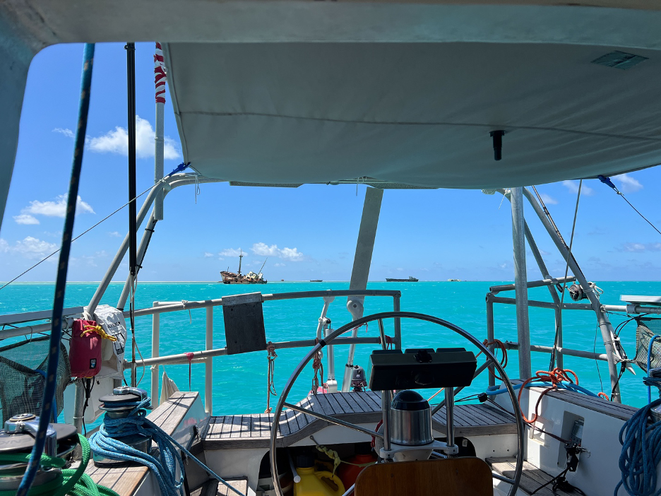
At first light we rounded the SE corner of Tarawa and made for the pass entrance. A large tuna boat and a ship were waiting for pilots, but we snuck in front of them and motored into what is arguably one of the worst anchorages in the Pacific (or at least that people regularly have to go to). The anchorage is between huge boats with no protection from the wind coming across the entire lagoon.

When we arrived it was a 25kt NE wind with a 15ish mile fetch. We almost kept going to the Marshall Islands once we got a peak at the wrecks scattered throughout the anchorage, but instead dropped the hook in 20’ of water with a nice sandy bottom, just upwind of a sunken WW2 landing craft and a diverse array of sunken ships. The only real downside was that our anchor roller was going under water in the waves coming through, and we received a report of a rat boarding another boat the month before and hitching a ride to their next port. There are also numerous reports of cruising boats being boarded and robbed, although that seems to mostly be one trumped up case. Nevertheless, we cleared in that afternoon (in 100 degree sweltering heat) and moved to a more comfortable spot half way up the lagoon. With skiffs zooming past all night and the warning about rats, we left every deck light on at night.

Tarawa is a bizarre place. Unlike most Pacific Island nations, they require that you arrive and leave from one (sort of terrible) island – Betio on Tarawa Atoll. After arriving and clearing in, you can then apply for outer island permits that you may or may not get. Then after visiting said outer islands you return to Tarawa to clear out. Despite a rule on the books allowing clearing in at one end of the archipelago and out from the other, there is exactly zero administrative / bureaucratic interest in making this possible. Almost every other cruising boat that we met decided to skip Kiribati for this reason or just stopped for fuel (while it has a reputation for being cheap, it also has a reputation for being about 50% water).

So, we experienced the interesting scene that is Tarawa for the 3 days that it took to get an outer island permit. We learned a lot about WW2 history given our visit landing on the 81st anniversary of the Battle of Tarawa. This tiny coral islet was the scene of one of the bloodiest battles that the marines fought in the entire Pacific war. It was also one of the first times that US casualties were filmed and shown to the American public. The video can be found HERE and is certainly worth visiting. It is wild to walk down the main road and see remnants of the battle and runway.

Also, until you’ve experienced Tarawa, hot is a relative term. It was like nothing we had ever experienced before or since. Imagine Death Valley level heat, but on a few-hundred-acre coral islet with 50,000 other people and all of their trash (mostly piled on the beaches or floating in the lagoon). Don’t let us get started on modern day Chinese colonialishism in the Pacific – Tarawa has Chinese stores, Chinese fishing boats, Chinese supply ships, a huge shiny Chinese embassy, Chinese restaurants, Chinese everything. I’d say that this is enough detail on Tarawa.

With the permit in hand thanks to an incredible young guy at the office of Immigration, we were off for the short day sail to Abaiang, about 25nm to the north. With most of the sail in the lee of Tarawa we had a wonderful sail, navigated through the shallow pass, and anchored midafternoon in beautiful silty blue water off the main town. The blue of the sky and water might be where the color actually came from.

We spent the next week and a bit exploring Abaiang, swimming, wing foiling, and eating good food. The evenings and sunsets were spectacular. The Kiribati flag pictures a sunset, and now we know why!

We met a very nice I-Kiribati / Swiss retired couple who live on Abaiang and enjoyed meals with them. Nick and Lisa came out to Kuaka for a Thanksgiving dinner complete with our mini-chickens and chanterelles from the Uvea supermarket. They also hosted us for an amazing raw tuna and coconut milk / rice dinner at their home – but we were so busy eating that we forgot to take any pictures.

We walked through the sprawling boarding school that attracts students from all over Kiribati and visited with the I-Kiribati guy who just built a very beautiful tiny resort on the ocean side of the atoll near the runway.

Abaiang fit the description of tropical island paradise, although with the interesting variable of a rapidly increasing and already significant population. It’s unclear what is driving this, but the population of 5,000 people on a small land mass seems to be pushing the limits of available resources. This is especially the case in a place with minimal rainfall, about 100 miles from the equator, with a (barely) subsistence economy, that some estimates put as underwater in as little as 50-100 years. We asked both locals and missionaries (who likely play a role in the lack of family planning resources available / growing population) about climate change and sea level concerns – apparently not a concern! Good to know.

With Thanksgiving celebrated to the point of waddling, we decided to continue our push north. That of course required going back south to Tarawa to clear out. This time we anchored closer to the main pier and the anchor roller stayed dry. Our anchorage neighbor “I-Tungaru” is certainly in the running for cutest tugboat in Kiribati.

After a full morning spent chasing officials around, we were ready to head out. Just before sunset we passed the final channel buoys and began the 3-day reach up to Majuro in the Marshall Islands.

Kiribati is a place of extremes – striking beauty, heart-wrenching poverty, shocking population density, and overwhelming pollution. We heard repeatedly from locals that things were better before the British left in the late 1970s. After witnessing the consequences of colonialism and imperialism throughout the Pacific, this is a sentiment that you don’t hear every day! And we couldn’t help but feel that we are seeing Kiritabati as China deepens its quasi-colonial presence. Time will tell what this means for the I-Kiribati people. But for now, the effectiveness of the current Chinese role is neatly summed up in the bizarre shirts sold at the Chinese supermarkets:

Another cruiser put it well. Are we glad that we visited Kiribati? – Yes. Would we go again? – probably not.